Village Boundaries
Find out more about our villages including details of village boundaries below:
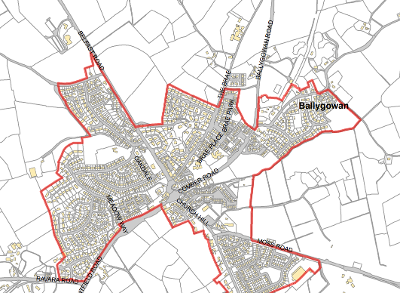
Ballygowan
Ballygowan is a busy commuter village located mid-way between Comber and Saintfield. It is less than 10 miles from Belfast. Ballygowan residents have access to a number of amenities in the area including a pharmacy. Most of the village's commercial activity is centred around the Square and Belfast Road. Translink operates its bus depot from the Saintfield Road.
Download the Ballygowan Village Boundary (PDF, 632 KB) (opens new window)
Ballyhalbert
Ballyhalbert is a coastal village located on the eastern side of the Ards Peninsula. The village lies midway between Ballywalter and Portavogie.
The village is primarily residential, featuring a supermarket, a primary school, a secondary school and a village hall, 'Talbot House'.
Download the Ballyhalbert Village Boundary (PDF, 480 KB) (opens new window)
Ballywalter
Ballywalter is a coastal village located on the eastern side of the Ards Peninsula. The village lies midway between Ballyhalbert and Millisle. The village contains a range of facilities including shops along its Main Street, two churches, community facilities and a health centre. The harbour area, the long sandy beach and the recently improved Lime Kilns are important tourist assets.
Download the Ballywalter Village Boundary (PDF, 480 KB) (opens new window)
Carrowdore
Carrowdore is a rural village located in the middle of the Ards Peninsula and has a Community Centre, a Community Hub, some retail provision around the petrol filing station and is home to Strangford Integrated College.
Download the Carrowdore Village Boundary (PDF, 488 KB) (opens new window)
Cloughey
Cloughey is a coastal village located on the eastern side of the Ards Peninsula. Renowned for its magnificent expanse of sandy beach, Cloughey is a quiet, pretty village with a beautiful sandy beach and unique flora and fauna.
Download the Cloughey Village Boundary (PDF, 424 KB) (opens new window)
Conlig
Conlig is located off the Bangor Road approximately halfway between the City of Bangor and Newtownards Town. The village is linear in nature comprising a number of residential estates that are accessed off the Old Bangor Road, which now forms the village's Main Street. The village has a convenience shop located centrally within The Green, a Presbyterian Church along Main Street and community buildings including a community centre and Orange Hall.
Download the Conlig Village Boundary (PDF, 580 KB) (opens new window)
Crawfordsburn
Crawfordsburn is a small, picturesque and historic village located between Holywood and Bangor, bounded to the north and east by Crawfordsburn Country Park. The village is approximately three miles west of Bangor.
Download the Crawfordsburn Village Boundary (PDF, 478 KB) (opens new window)
Greyabbey
Greyabbey is a small Village and townland located on the eastern shores of Strangford Lough on the Ards Peninsula. It is a busy, thriving village full of antique shops, artisan shops, coffee shops and a wedding venue.
Download the Greyabbey Village Boundary (PDF, 457 KB) (opens new window)
Groomsport
Groomsport is a historic and picturesque village located two miles north east of Bangor. It is situated on the south shore of Belfast Lough and between Ballymacormick Point and Orlock Point. The village offers a range of places to enjoy food and other retail provision.
Download the Groomsport Village Boundary (PDF, 507 KB) (opens new window)
Helen's Bay
Helen's Bay is a picturesque semi-rural villages mainly located within the townland of Ballygrot between Holywood, Crawfordsburn and Bangor. The village lies four miles west of Bangor and is only one mile west of Crawfordsburn.
Download the Helen's Bay Village Boundary (PDF, 517 KB) (opens new window)
Killinchy
Killinchy is a small rural village in County Down, taking in the communities of Balloo and Whiterock. Situated on top of a hill, Killinchy is close to the western shores of Strangford Lough, which is a recognised Area of Outstanding Natural Beauty.
Download the Killinchy Village Boundary (PDF, 362 KB) (opens new window)
Kircubbin
Kircubbin is a village and townland located on the eastern shores of Strangford Lough on the Ards Peninsula. It contains many shops and commercial properties along its Main Street. It is also home to two primary schools, a nursery, several churches and Maxwell's Courtyard, a two storey community building.
Download the Kircubbin Village Boundary (PDF, 460 KB) (opens new window)
Lisbane & Lisbarnett
Lisbane is a small rural hamlet located midway between Balloo and Comber and is less than two miles from the western shore of Strangford Lough. The village is home to the popular and highly acclaimed Poacher's Pocket restaurant. The Old Post Office in Lisbane is a Grade II listed building dating back to the 1840s and provides tea rooms, pantry and a gift shop.
Download the Lisbane & Lisbarnett Village Boundary (PDF, 457 KB) (opens new window)
Millisle
Millisle is a popular seaside resort with an extensive sandy beach and a man-made lagoon. Steeped in history and beauty, it was given the name due to the number of mills that operated in days gone by.
Download the Millisle Village Boundary (PDF, 545 KB) (opens new window)
Portaferry
Portaferry is a large village at the southern end of the Ards Peninsula near the Narrows at the entrance to Strangford Lough. Portaferry is home to Northern Ireland's only aquarium, Exploris, and contains a range of commercial outlets along its central streets. The village also contains a number of churches, a marina, a quay, its own castle and a passenger/car ferry service which operates daily at 30 minute intervals between the Village and neighbouring Strangford.
Download the Portaferry Village Boundary (PDF, 567 KB) (opens new window)
Portavogie
Portavogie is a village and fishing port situated on the eastern shore of the Ards Peninsula. It is an important maritime centre because of its location and rich supply of superb seafood in local waters. It has a petrol station, chandlers, barbers, chip shop and Quays restaurant.
Download the Portavogie Village Boundary (PDF, 488 KB) (opens new window)


